INVENTORY #143416
The History of England. Vol. IV. Part II.
DE THOYRAS, Rapin; TINDAL, N.
Regular price
$1,000.00 CAD
Sale
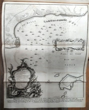
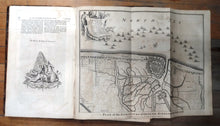
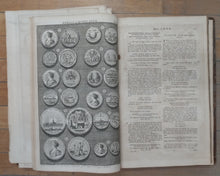
Title continues: "by Mr. Rapin de Thoyras. Continued from the Revolution to the Accession of King George II. By N. Tindal, M. A. Rector of Alverstoke in Hampshire, and Chaplain to the Royal Hospital at Greenwich. Illustrated With the Heads of the Kings, Queens, and several Eminent Persons; also with Plans of Battles and cities, Maps, Medals, and other Copper-Plates." Text discusses the reign of George I. Next section describes the medals issued during the reign of Queen Anne and King George I. Followed by "A Summary of the History of England. From the Invasion of Julius Caesar to the Death of King George I." Finally has lists of the Kings and Princes of Wales, chancellors, English archbishops and bishops, chief justices, justices, barons, knights of the Bath, admirals of England. Index at rear. 15 fold-out maps or plans as follows: Draught of ye Bay of Bulls between the Town of Rotta and Fort St. Catherine, under the Command of his Grace the Duke of Ormond, with the disposition of the Frigates which were ordered to stand in by the Shore, to favour the Landing, as also the Situation of the Ground and Bay, with that of the Enemy's Batteries & Troops; An Exact Draught of the Bay and Harbour of Vigo; Plan of the Works of the City of Messina, one of the strongest and most considerable Cities of Sicily, and a fine Sea-Port; Plan of the Battle of Eckeren; Battle of Maestricht; Plan of the Town and Fortification of Gibraltar, exactly taken on the Spot in the Year 1738; Plan of the Lines of Brabant Forced July 18, 1705 by the Army of ye Allies, commanded by His Grace the Duke of Marlborough, & Felt-Marshal D'Averquerque. Designed upon the Spot by Monsr. Divoy Colonel and Quarter-master General of the Army of the States General; Plan of the City of Barcelona; Plan of the Investiture of Ostend Surrendered, 6 July 1706; Menin; Mechlin, or Malines the Capital of one of the ten Provinces of the Netherlands in Brabant an Archbishoprick, situated upon ye Dyle; Plan of the City of Dendermonde, and the manner in which it was blocked by the troops of the Allies; Aeth a Strong Frontier Town in Brabant, taken by the Duke of Marlborough in 1706; Plan of Turin as Besieged in 1706; A View of Casal, a very strong City and Castle in Italy, taken by the Duke of Savoy in December, 1706.
Publication Info
- Publisher: John and Paul Knapton
- Edition: n/a
- Date Published: 1747
- Place Published: London
- ISBN: n/a
Details
- Condition: Poor
- Signed: No
- Dust Jacket: No
- Jacket Condition: n/a
- Details:
Pages 394-714, 1-274, [29], interspersed with plates. 41 cm. Frontispiece portrait of King George I and 2 other portraits. Title vignette and 2 decorations. 2 plates illustrating the Great Seals of George I and Queen Anne. 10 plates illustrating medals numbered I to X. 15 fold-out maps or plans. Full leather. Black and red title page. Text in 2 columns. From our As Is shelf. Split in three sections at plan of Mechlin and p. 247. Newer hand-printed spine label is partly missing. Large tear in spine tail. Corners and edges worn. Large tear in p. 595. Some smaller tears elsewhere. Offsetting from maps. Plans of Mechlin and Aeth detached. A few scattered ink notes. Dampstains to margins of rear pages. Armorial bookplate on both pastedowns.


