

INVENTORY #2006
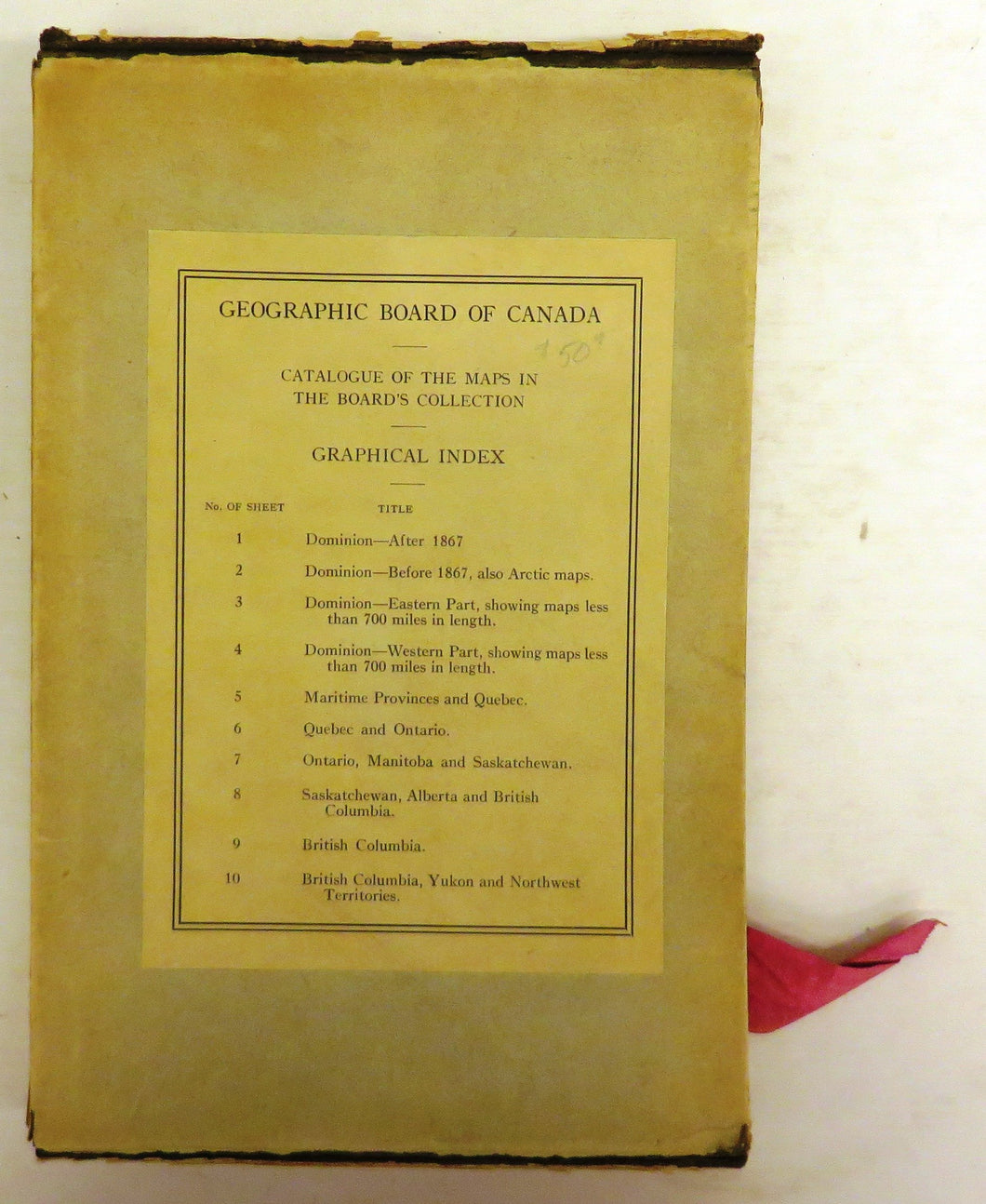
10 maps from the Geographic Board of Canada
Geographic Board of Canada
Regular price
$35.00
Sale
Includes: 1. Dominion -- After 1867; 2. Dominion -- Before 1867, also Arctic maps; 3. Dominion -- Eastern Part, showing maps less than 700 miles in length; 4. Dominion -- Western Part, showing maps less than 700 miles in length; 5. Maritime Provinces and Quebec; 6. Quebec and Ontario; 7. Ontario, Manitoba and Saskatchewan; 8. Saskatchewan, Alberta and British Columbia; 9. British Columbia; 10. British Columbia, Yukon and Northwest Territories.
Publication Info
- Publisher: Geographic Board of Canada
- Edition: n/a
- Date Published: 1922
- Place Published: Ottawa
- ISBN: n/a
Details
- Condition: Good +
- Signed: No
- Dust Jacket: No
- Jacket Condition: n/a
- Details:
26 cm. 10 colour maps of Canada printed at the Surveyor General's Office, 1922. The folded maps are in excellent condition and are contained in a box. The box has tears and cracks, but retains the pink ribbon used to pull the maps in and out. Box has label listing the maps with the title "Geographic Board of Canada. Catalogue of the Maps in the Board's Collection. Graphical Index." This is not the catalogue or the index, but a series of 10 maps that likely accompanied them.